Find the various lists of maps of Ireland, ranging from Administrative to travel friendly maps of Ireland.
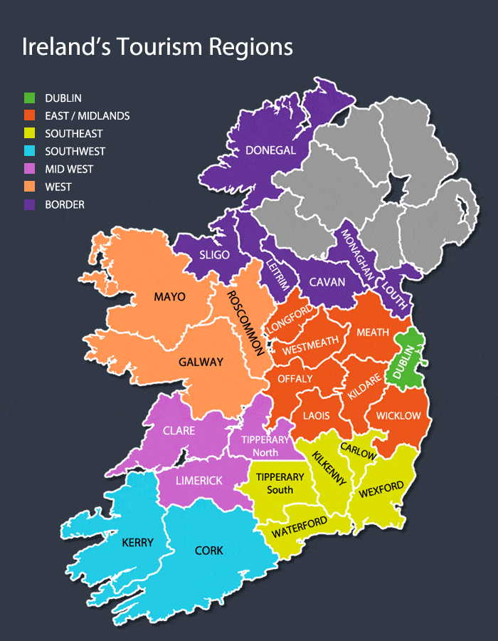
Map of Ireland’s Tourism Regions
The map of Ireland’s tourism regions illustrates the various tourist counties in the country. The greyed area is Northern Ireland which is a part of the United kingdom.
The Irish tourism has grown tremendously in the past few years. This is attributed to many factors like the country’s history, culture, natural beauty, and people. Ireland has become a very popular tourist destination with over 20 million visitors coming each year. The number of tourists is increasing each year due to Ireland’s literary legacy and spectacular scenery.
Ireland’s tourist attractions are varied and are linked to its long history as a location of religious, political and educational importance. For example, tourists can visit historical sites such as Newgrange where people have been buried for 5,000 years ago or they can witness the Giant’s Causeway with its myths of giants building it.
Tourism is an industry that relies on sites of natural beauty. It is also one of the most heavily exploited industries in the world. Many people think that tourism should be eliminated entirely or at least regulated, but it’s impossible to do so when the industry has been around for so long.
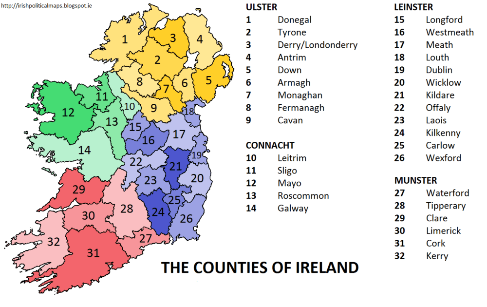
Provinces and Counties of Ireland Map
The Republic of Ireland is divided into four Irish provinces. These are Ulster, Leinster, Munster and Connacht. The provinces are further divided into counties which serve as the primary units of local government in the country.
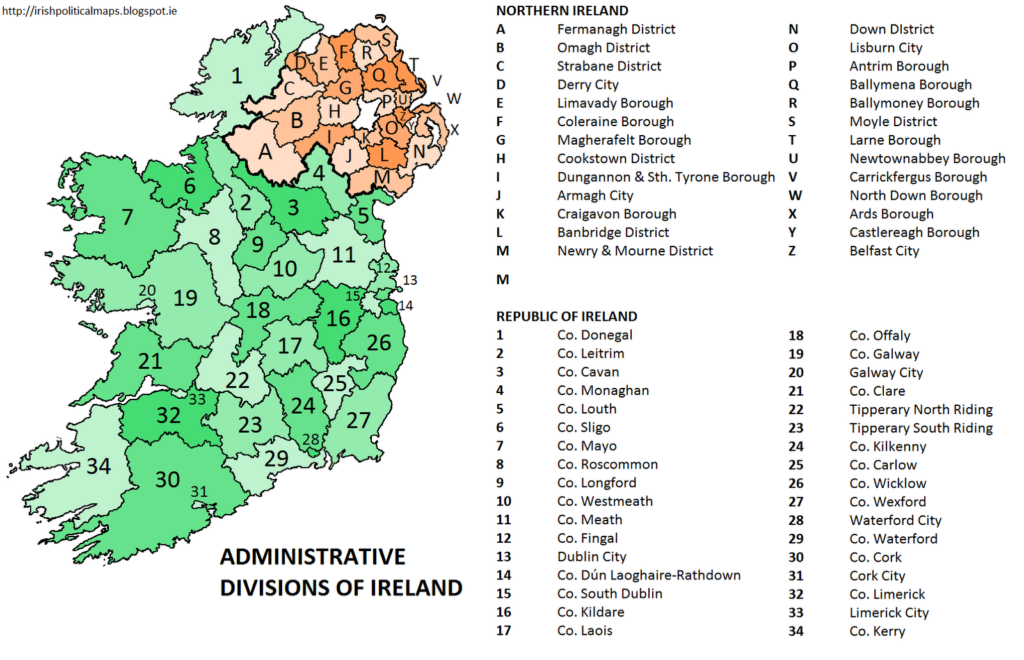
Administrative Map of Ireland
The administrative map of the Republic of Ireland is divided into two constituent parts – Northern Ireland and the Republic of Ireland. Northern Ireland is part of the United Kingdom while the Republic of Ireland is an independent country.
Road Maps Of Ireland
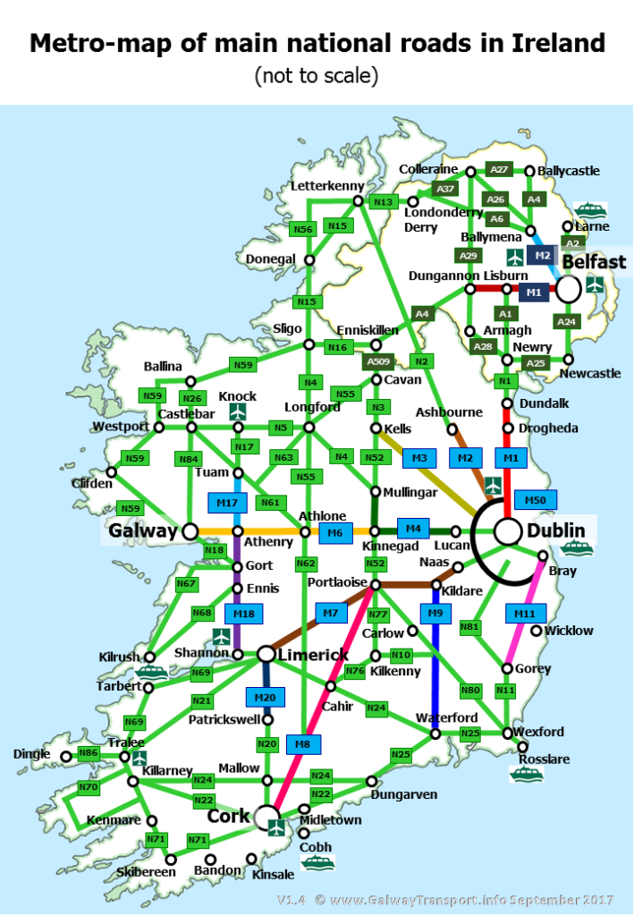
Ireland road Map 1
The road network in the Republic of Ireland is administered by the National Roads Authority. The authority is responsible for the national primary routes, national secondary routes, Regional roads and motorways in Northern Ireland.
Driving in Ireland and its country side
Ireland is a stunning country with many breathtaking attractions. The Irish countryside and the seacoast are also very scenic and beautifully preserved. However, driving in Ireland can be quite challenging as drivers must contend with narrow roads, bad weather and local drivers who may not follow the rules of the road.
Ireland Road Map 2
Ireland has a well developed road network with an extensive system of national primary roads. Motorways are largely confined to the outskirts of the country’s larger cities. Lesser roads are generally single-carriageway apart from some major regional roads which are dual carriageway with some sections being up to motorway standard.
The Irish road network is one of the most heavily trafficked in Europe, leading to significant congestion and delays. In recent years, the government has been lowering the speed limits on national secondary and tertiary routes in order to reduce accidents and improve safety.
Tourists are allowed to drive cars in Ireland with the right insurance, but they must be careful to obey the rules of the road.
Irish Rail Map
The Irish rail network, or Iarnrod Eireann, is made up of two separate networks, the Northern Ireland Railways (NIR) and the Republic of Ireland’s Iarnrod Eireann (IE). The NIR operates trains in Northern Ireland, while the IE operates trains on the island of Ireland.
Even though Ireland is known for its extensive road network, it is still heavily reliant on trains for public transportation between large cities.
Ireland by rail is a great way to explore the country by train. It may be the most scenic way to get around Ireland and enjoy the country’s magnificent countryside. The railway system in Ireland is very well developed. More than 18,000 miles of track crisscross the country and links towns, villages and cities together. The railway network in Ireland stretches for over 2,500 miles. This network connects virtually every town and village with at least one station to the other parts of the island.
The Irish railway network is operated by a single state company called Iarnród Éireann that provides passenger train services across the island of Ireland, from Belfast in Northern Ireland to Cork, Dublin and Galway in Southern Ireland.
The idea of travelling by train in Ireland is one which many people find appealing. Tours are available in every province, and because trains go to both Ireland’s beautiful seacoast and its mountainous interior, it is often possible to see the beautiful green countryside on the way to your next destination.
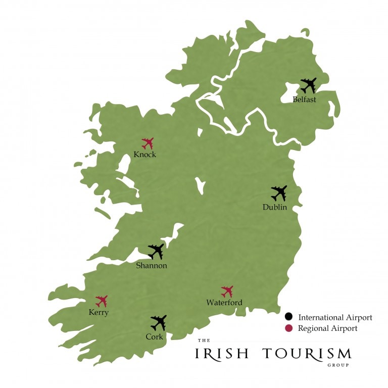
Airports Map Ireland
Ireland has 4 international airports: Belfast International Airport (BFS), Cork Airport (ORK), Dublin (DUB), and Shannon (SNN). There are also smaller regional airports like Galway Airport, Donegal Airport, Sligo Airport, Waterford Airport and Kerry Airport. Dublin airport is the largest airport in Ireland with an annual passenger capacity of over 22 million people per year with over 100 airlines flying into it annually. Dublin airport has the most passengers of any airport in Europe – about half of Ireland’s population travels through Dublin airport every year!
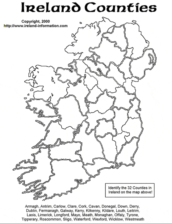
Printable Irish County Map
Knowledge check time. If you have been to Ireland then it should be easy for you to list all counties on this blank Ireland map. Go ahead print this blank Ireland map and test your knowledge. Its fun try it. The list of counties is given at the bottom for your assistance.
Printable Irish County Map
Google Map Of Ireland
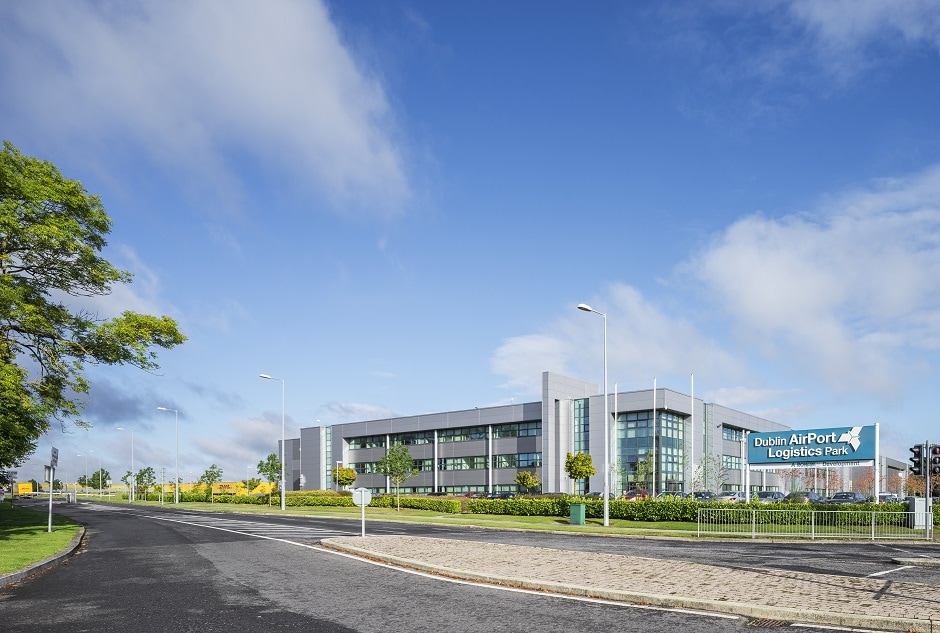
Visit Aerfortel for more details about our airport hotel services.
